 Worldlex Wiki
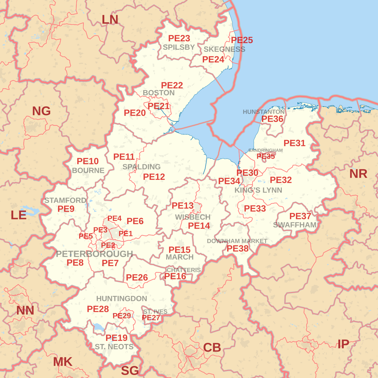
 The PE postcode area, also known as the Peterborough postcode area, is a group of 36 postcode districts in eastern England, within 18 post towns. These cover north and west Cambridgeshire (including Peterborough, Huntingdon, Chatteris, St. Neots, St Ives, March and Wisbech), much of south and east Lincolnshire (including Bourne, Stamford, Spalding, Boston, Skegness and Spilsby), and west Norfolk (including King's Lynn, Hunstanton, Sandringham, Swaffham and Downham Market), plus the north-easternmost part of Northamptonshire, the easternmost part of Rutland and very small parts of Bedfordshire.
Coverage
The approximate coverage of the postcode districts:
The original PE17 and PE18 districts for Huntingdon were recoded to PE26, PE27, PE28 and PE29 in late 1999. The St. Neots and St. Ives post towns were created at the same time, the PE19 district having formerly been part of the Huntingdon post town.
Map